Outdoor long exposure photographs are a co-creation of nature and photographer. The photographer must track and hunt nature’s creations to get a successful long exposure photograph. Nature makes its own plans which cannot be influenced by the photographer (fortunately not). So you cannot plan and control long exposure photography like in a studio shooting. But nature’s plans follow stable rules – the laws of physics. And if the photographer understands these rules he can anticipate and prepare upfront for long exposure photographs. And be there when nature is creative and cooperating.
For me, understanding and reading nature – and weather particularly – with respect to long exposure photography was the biggest learning. I have been always interested in weather and its physics behind, and I have a good enough understanding of the local weather here in northern Germay. But despite this background I had to learn which weather is best for long exposure photographs and how weather conditions will develop with respect to its photographic potential. And with these learnings I am now able to anticipate fairly well where and when I have to be in order to make long exposure photographs. And when it is time to grab the camera bag and get out for tracking and hunting nature’s creations.
Reading the Weather – Cloud formations
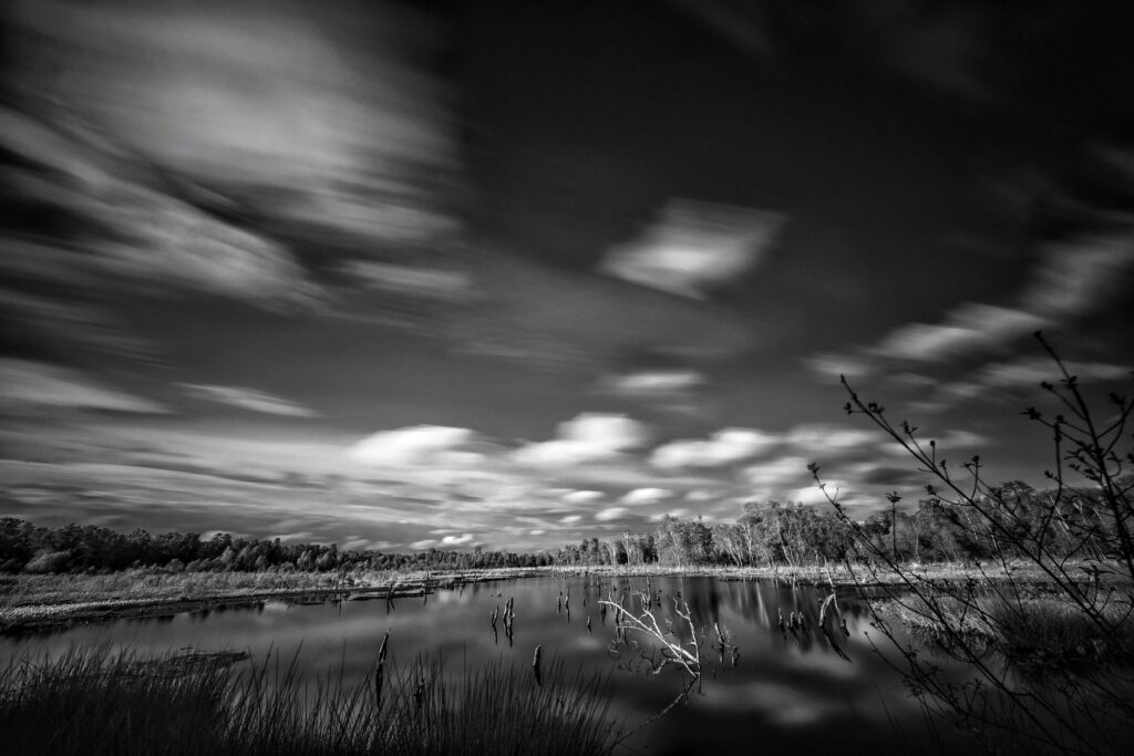
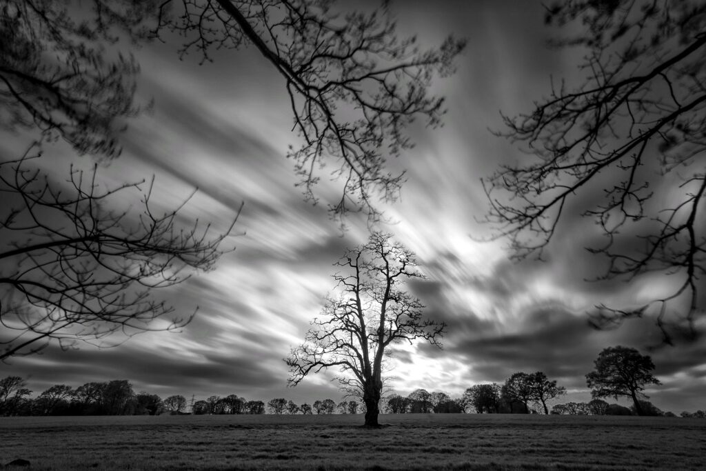
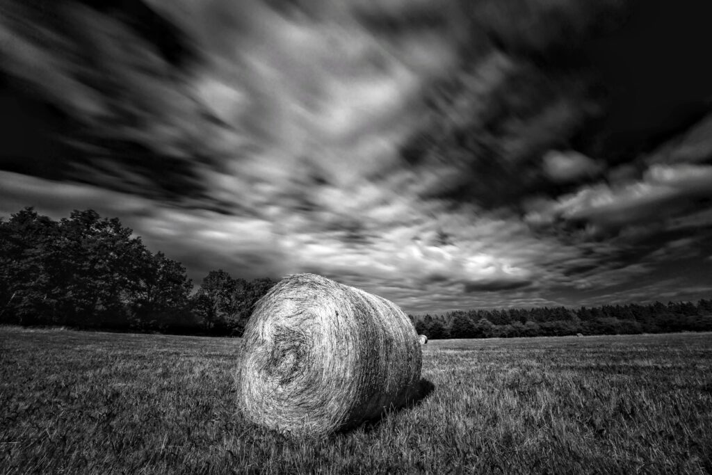
In long exposure photography I always try to use the special dynamic effect of moving clouds. This effect adds depth and dynamics and creates an almost three-dimensional look to subjects which otherwise may look flat and maybe even boring. So cloudy weather is a must. But it has to be the right kind of clouds, too:
- Good Texture: there must be enough texture in the sky and clouds. A partly cloudy sky is best. A mix of bright and dark clouds also helps.
- More than 50% Cloud Coverage: there should be enough clouds, preferrably more clouds than open sky. Single isolated clouds in anotherwise clear blue sky will not give the best effect.
- Cloud Movement: Moderate to strong winds will create enough cloud movement. Static and slowly moving clouds do not create the proper effect.
Depending on where you are located you will find out that those conditions can be quite rare. I live in northern Germany where weather is fairly variable and windy (which is good, for long exposure photography anyway) and still there may be weeks without a good day for long exposure. So you have to be patient and watch the weather forecast. Some weather conditions have a good potential:
- Frontal system clearing: After the rain of a frontal system has moved through the area there is often a period where skies are partly clearing up and offer good opportunities for long exposure. The best cloud formations often follow the rain immediately, so be prepared to get wet first before you are rewarded with good cloud formations.
- Autumn storms: These storms often bring periods with mixed clouds and rain showers and strong winds, and chances for long exposure are good. And with strong winds (6 bft and up) you sometimes can manage with just 15 seconds of exposure. In strong winds working with a high tripod may become a problem, as the wind might just blow away your gear.
- Shower systems: all kind of shower systems, spring, summer and fall will have a good potential for long exposure, as the clouds and the light are constantly changing.
- Transition periods: In general, all weather transition periods when the weather is changing from one stable state to another state are something to watch for. Clouds moving in or out, changes from rain to sunny weather and so on are situations which favour long exposure photography.
In general, all these weather conditions are rather unstable and come and go quickly. There is often just a period of 15 to 30 minutes where conditions are right for long exposure photography. I watch the weather forecast, rain/cloud radar and webcams carefully to anticipate precisely when and where the conditions might be good – and when exactly I should grab the camera bag and get to the spot in time. This takes some practice.
Reading the Weather – Wind direction and wind speed
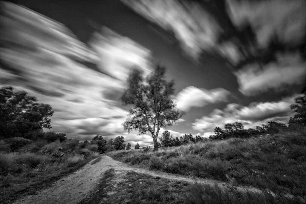
Wind direction relative to the camera view axis is important for long exposure, as this will determine the type of cloud effect on the photograph. Basically there are two very different types of cloud effects to be expected, depending on the alignment of your camera view with the wind direction:
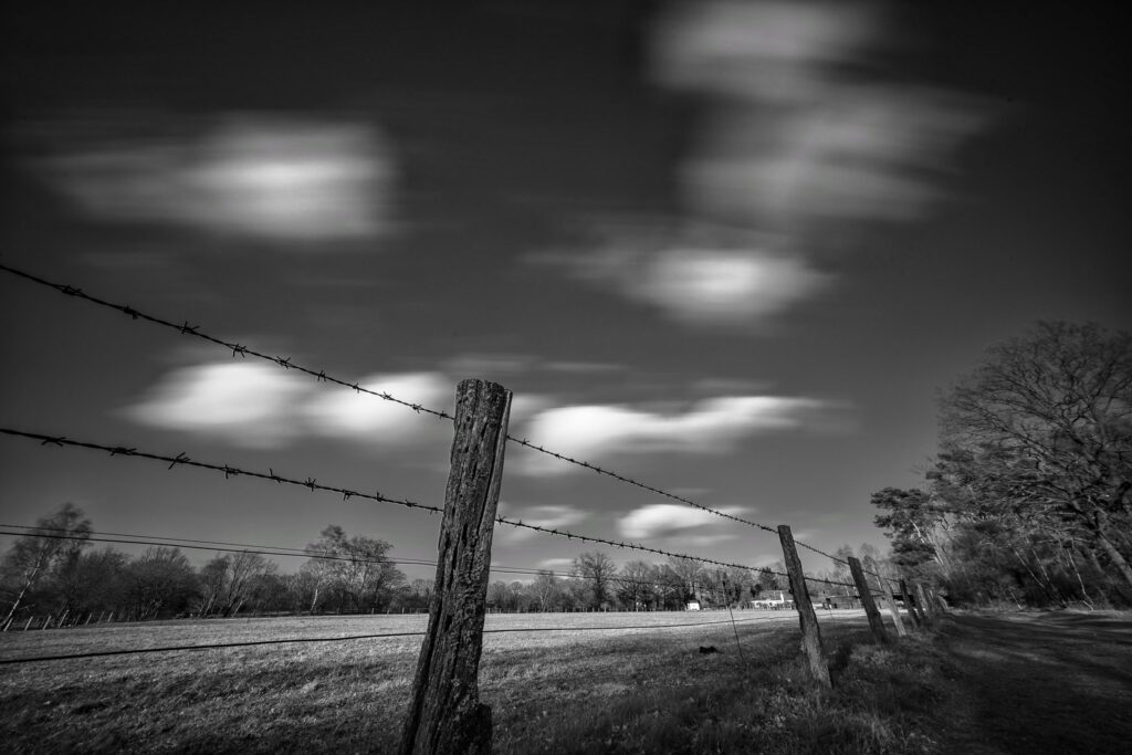
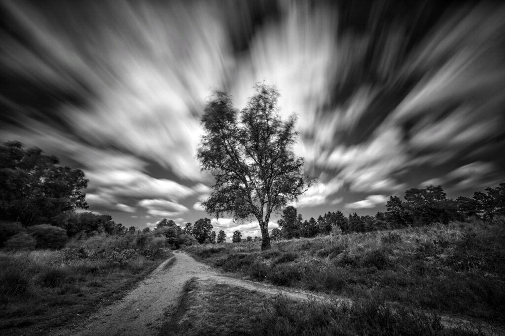
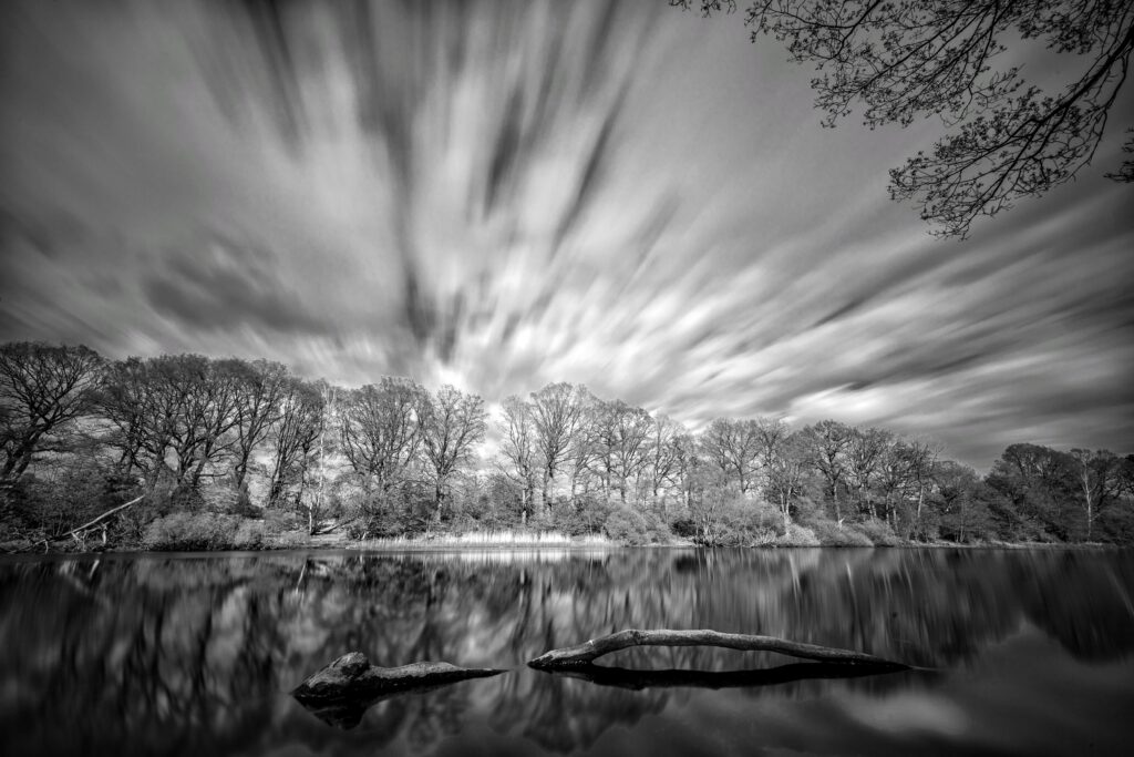
- Parallel: Camera view axis aligned parallel to wind direction. The cloud effect will be a very dynamic, explosion-like cloud pattern. It doesn’t matter if you align the camera with or against the wind, the effect will be the same.
- Perpendicular: Camera view axis aligned at 90 degrees relative to the wind direction. The effect will be soft, cotton-ball like clouds.
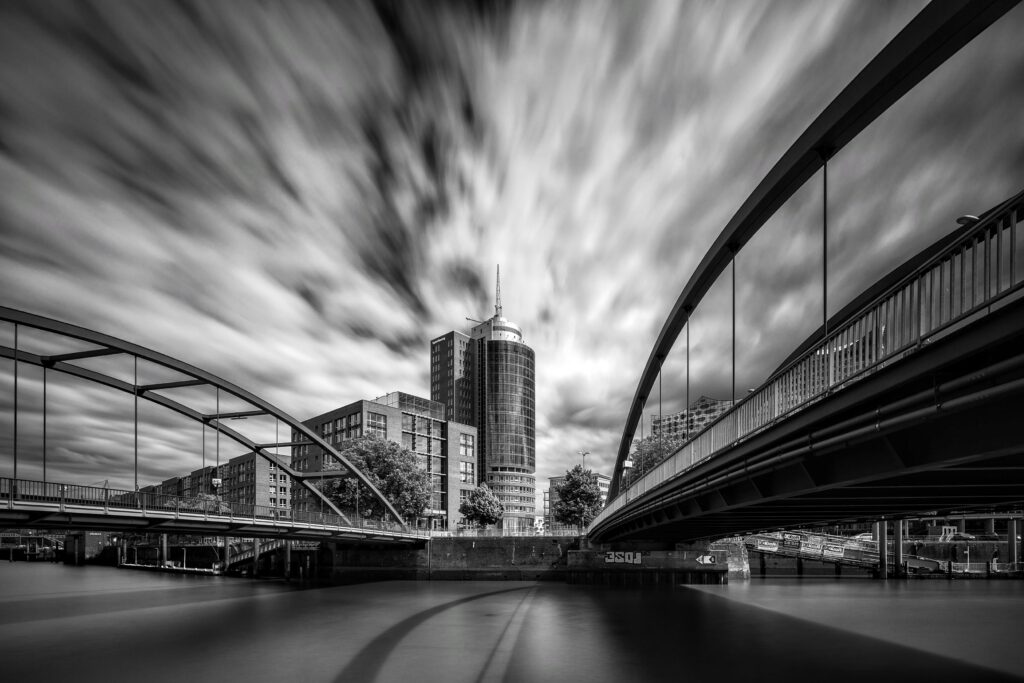
And of course, if you align the camera somewhere in between parallel and perpendicular the result will also be a cloud effect somewhere in between those two opposites.
Wind speed, and the speed of the moving clouds, is also something to factor into a long exposure photograph composition. For each wind speed there is something like an optimum exposure time to produce the right degree of cloud effect with good texture. If exposure time is too short, the cloud effect is barely visible. If exposure time is too long, the clouds will be stretched too wide and texture is reduced. I have found these exposure times a good starting point:
- Wind speed at 5 to 6 bft: 15 seconds exposure
- Wind speed at 3 to 4 bft: 30 seconds exposure
- Wind speed at 2 bft and less: 1 – 2 minutes
Checking predicted wind speeds before a photography session is certainly recommended. When I start a long exposure photo session I will normally shoot two images with exposure times differing by a factor of 2, to get calibrated on the current wind speed. Once calibrated, I will leave exposure time fixed throughout the session and adjust exposure by changing ISO number or aperture. Wind speed will remain fairly constant for hours.
Direction of sunlight
Every cityscape and landscape photographer knows how important the direction of sunlight is for image composition. Texture and contrast of an image will be very different if you shoot with the sunlight, straight into the sunlight or at an angle. All that is of course equally valid for long exposure photography. But the outcome of the direction of sunlight will be somewhat different in long exposure photography.
Shooting straight into the sunlight is always a challenge, as contrasts will be strong, the dynamic range needed will be high and lenses will be subject to flare. Shooting into the sunlight in long exposure photography is even more challenging: yet more contrast, a risk of washed-out highlights and even more flare risk due to filter and filter holder. And lenses that will normally produce nice-looking sunstars will also fail in that respect. I find it almost impossible to produce a good long exposure when shooting straight into the sunlight – simply too many unwanted effects and artefacts. Only when cloud coverage is strong and thick clouds will hide the sun for the duration of the exposure there is a chance to get a good long exposure photograph with the camera directed into the sun.
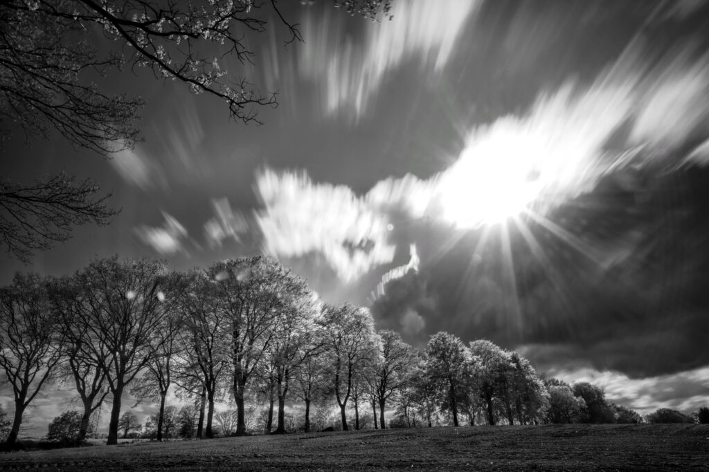
The lessons learned are:
- Avoid shooting long exposure directly into the sun.
- You can risk a long exposure when the sun will be covered by thick clouds for the length of the exposure
- Make sure that the sun is at least at a 45 degrees angle.
- Shooting with the sun in your back can actually create quite nice effects. Normally you will risk a flat-looking image, but the long exposure effects can compensate for this.
Wind direction and direction of sunlight
There are interdependencies between wind direction and direction of sunlight to be considered in long exposure photography:
- For your subject you may want to shoot in parallel to the wind direction, to get the maximum dynamic cloud effect
- However, current direction of sunlight may just prevent this
I therefore had to learn to take into account the combination of direction of sunlight and wind direction, and to plan and prepare my long exposure photo trips accordingly. There are subjects / viewpoints for long exposure which are best photographed in the morning (sunlight from east to southeast), and others are better suited for the afternoon (sunlight from southwest to west). The same subject / viewpoint may be best captured in long exposure with wind from northwest, and other subjects / viewpoints will work better with southwest winds.
For planning long exposure photo trips, I have therefore created a kind of personal mental map of my surroundings where interesting subjects / viewpoints are divided into:
- Morning subjects (avoid shooting east to southeast to south) and afternoon subjects (avoid shooting south to southwest to west)
- Subjects for northwesternly winds and subjects for southwesternly winds – these are the dominant wind directions here in northern Germany
This map helps me to select the right subjects and viewpoints in advance, and avoid unnecessary trips with little potential.
Using the weather app
These days it is easy to check weather forecast, cloud formation and wind direction using a weather app on your mobile phone. I use the weather app for upfront planning but also the check local and current developments when I am on a photo trip. Two features are particularly helpful:
- The general weather forecast (24 hrs, next days and/or next weeks). This gives me a rough indication if there is some potential for long exposure photographs in the next days. Days with mixed weather have the biggest potential.
- The rain / cloud radar map with animated forecast. This tells me quite reliably what kind of local cloud patterns I will encounter and what the wind direction will be over the next 1 to 3 hours. If I see potentially good conditions developing on the map I might grab my camera bag and go for a trip. Also, the animated forecast map will tell me during the trip if it is worth waiting on the spot for better conditions and light.